Citation
Erik H. Schmidt, Megan M. Johnson and Rocio Uría-Martínez. 2025. Map of U.S. Hydropower Development Pipeline, 2025. HydroSource. Oak Ridge National Laboratory, Oak Ridge, Tennessee, USA. DOI: 10.21951/HMR_PipelineMaps/2569209
Overview
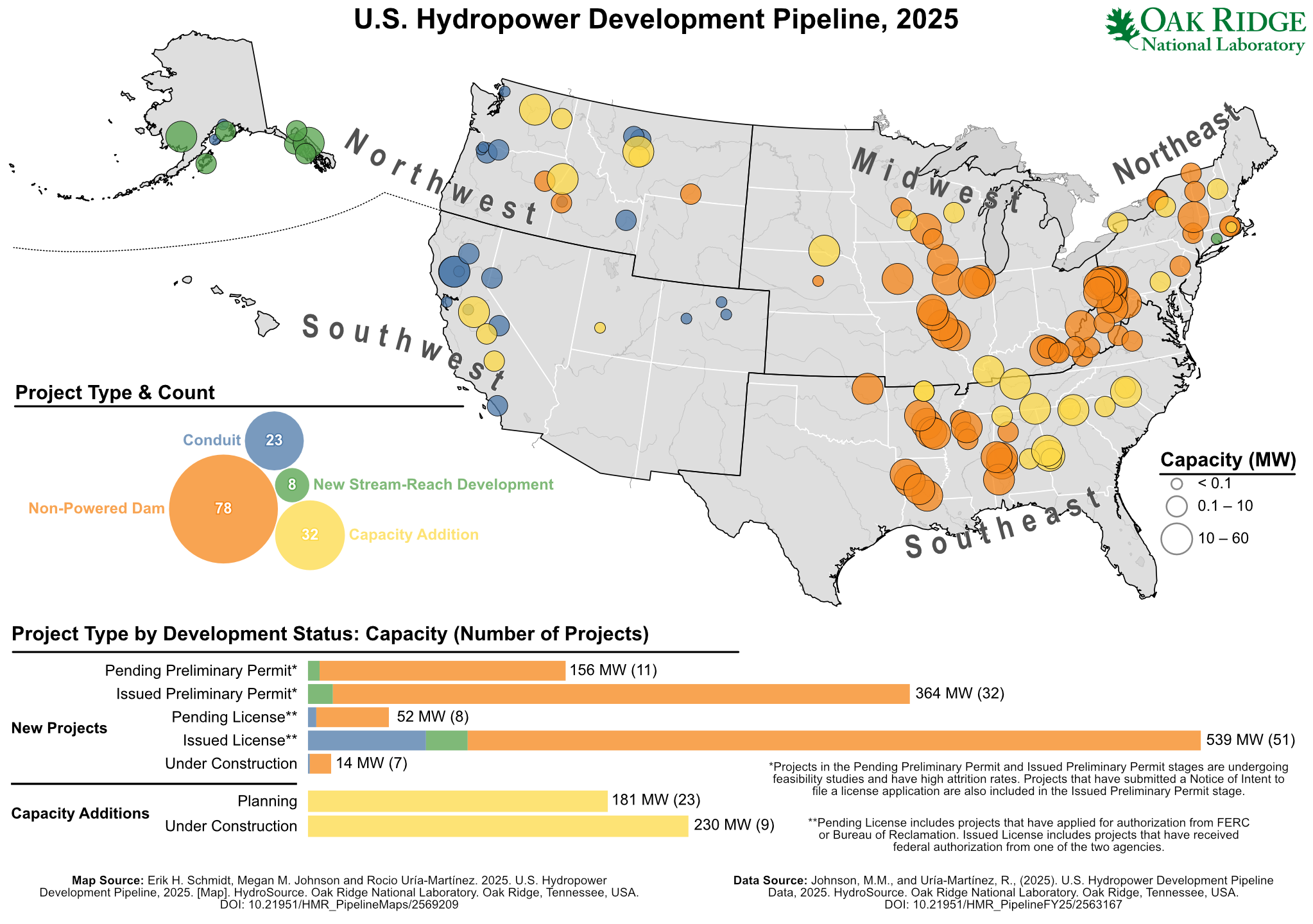
This map provides a snapshot of the composition of the U.S. hydropower development pipeline as of December 31, 2024. It displays the location of hydropower projects whose developers have formally registered interest in project development through documents submitted to FERC or Bureau of Reclamation. The map provides project-level information on size and type as well as a summary of the number and capacity of projects at each of stage of development.
Science Themes
Related Records
U.S. Hydropower Development Pipeline Data, 2025
The U.S. Hydropower Development Pipeline database is a snapshot as of December 31, 2024 of locations and key characteristics of U.S. hydropower projects that are in the permitting/licensing/exemption phase and yet to be operational.
View Dataset