Citation
2023. The Interactive National Hydropower Map. Oak Ridge National Laboratory, Oak Ridge, Tennessee, USA.
Overview
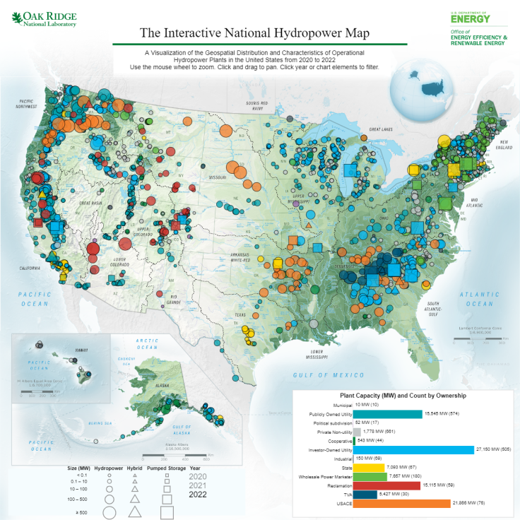
The Interactive National Hydropower Map displays the geospatial distribution and characteristics of U.S. operational hydropower plants.
Science Themes
Related Records
Existing Hydropower Assets (EHA) Plant Database, 2023
The Existing Hydropower Assets (EHA) Plant Database is a geospatially comprehensive point-level dataset containing locations and key characteristics of U.S. hydropower plants that are currently operational.
View Dataset